The Borneo100 courses are overall finalized, although final checking prior to the race may still lead to minor updates prior to the race. GPX files will be provided for download in the Dropbox well in advance of the race to aid in navigation during the event.
Brief Course Outline
Whereas the 100-mile course has been designed to be mostly runnable with less technical trails, the participants will get a taste of a bit of everything ranging from undulating gravel and dirt roads, trails up to some of the local hill tops running through a variety of forest and open grassland, sections along ridges with sweeping views over the surrounding hills to both the ocean and Mt. Kinabalu, and substantial stretches on almost flat tracks through wetlands and along paddy fields with a prolific bird life.
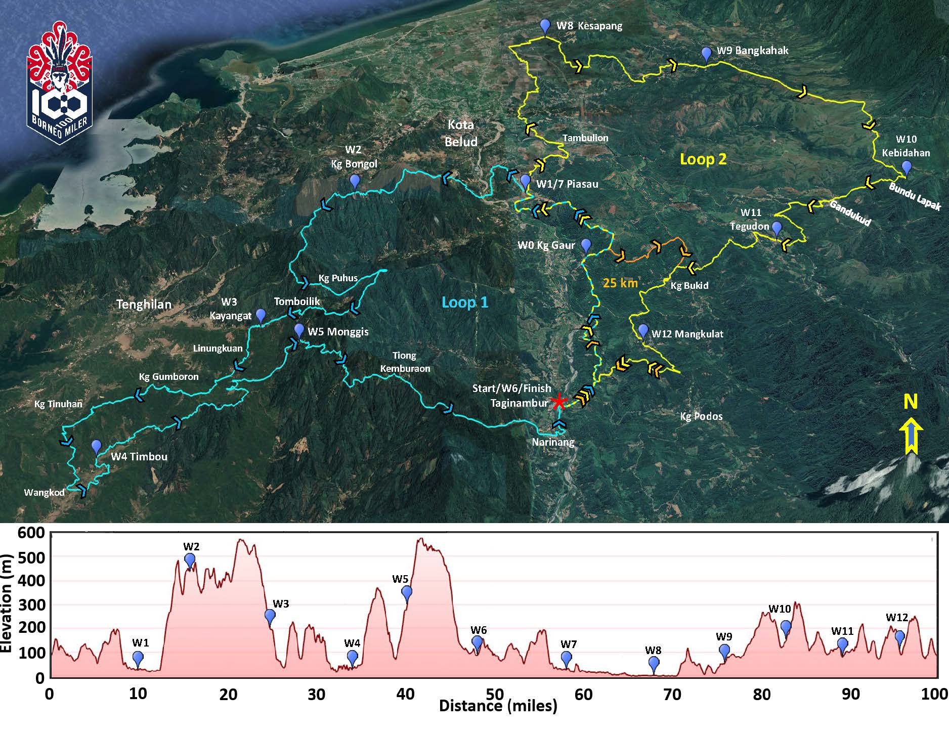
The 100-mile course is laid out with two separate loops going out from the central start/halfway/finish area as outlined below. The first loop (Loop 1 marked in blue) is the more hilly part with an accumulated elevation gain exceeding 3,500 m and some steeper sections to take in a couple of the local peaks. The terrain is mostly rolling hills with some steeper sections, but also includes a couple of flatter sections along paddy areas. All participants should get a chance to enjoy the views from the ridges in daylight.
The second loop (Loop 2 marked in yellow on the map) after passing over some of the rolling hills from Loop 1 extends out to a large wetland / paddy field area with about 15 miles with very limited elevation differences where runners can stretch their legs on mostly dirt and gravel tracks between paddy fields and along rivers and irrigation channels. Those reaching this area during daylight hours will often have the opportunity to experience a prolific birdlife (depending on the climate and growing season at the time of the race). At night, it is common to encounter nightjars with eyes that glow in the light of the headlamp. After the wetland/paddy area, the terrain is back into rolling hills with a mix of grassland, plantations and forest. Although some of the hills are steeper, most remain runnable for a strong runner with shorter sections of more technical trails that need to be negotiated with more care. The accumulated elevation gain of the second loop is in the order of 2,300 m.
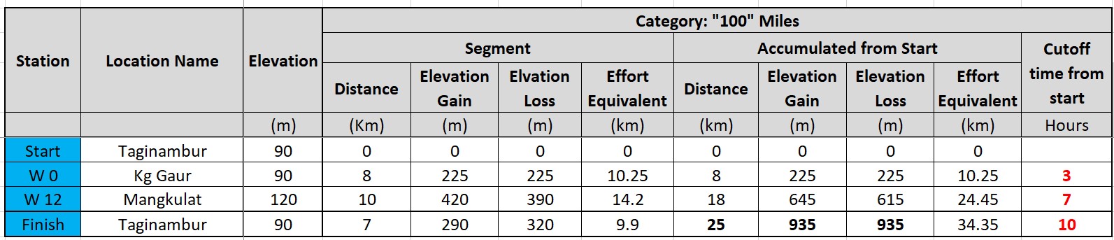
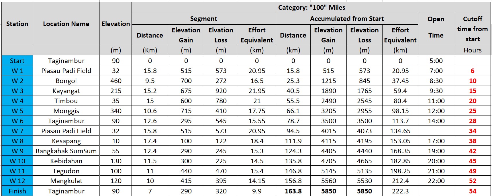
There are aid stations with water and food and rest opportunity at selected stations every about 10-18 km. Details of distances and elevations between Aid stations are tabulated below the figure. The table also includes an "Effort Equivalent" measured in km. This is taking the positive elevation gain into account in estimating an equivalent distance in flat terrain to aid in estimating the water and nutrition needs between stations.
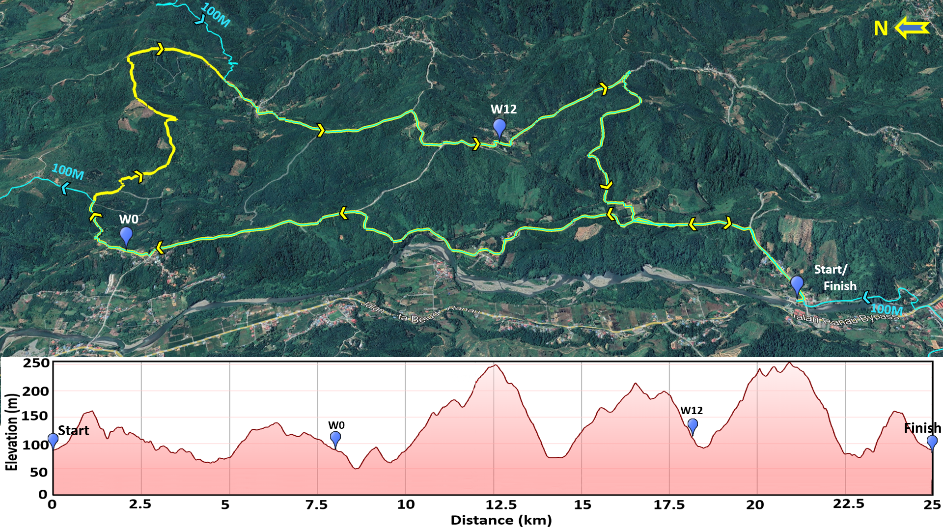
25 KM Course
A 25 km course has been added to the 100-mile course to provide the opportunity for runners who are not up to the full 100-mile course to be part of the event. The 25 km course follows the first part of the 100 Miler course and then cuts over to rejoin the finishing kilometers of the 100-mile course. The course is mainly on gravel and dirt roads with shorter trail sections through undulating hills. The course has an accumulated elevation gain in the order of 930 m. The 25 km course has two aid stations along the course with distances between aid stations ranging from 7 to 10 km, see table below the course map.